Current Valley Conditions: Updated Friday July 26, 2024 at 21:00 PDT

17.0°C
Sunrise: 05:34 | Sunset: 21:02
Current Valley Conditions: Updated Friday July 26, 2024 at 21:00 PDT
63°F
Sunrise: 05:34 | Sunset: 21:02
Valley Forecast
Issued:
Friday July 26, 2024 at 16:00 PDT
Tonight

Clear. Becoming partly cloudy this evening. Low 10.
Saturday

Sunny. Becoming a mix of sun and cloud in the afternoon. High 25 except 28 near Pemberton. UV index 7 or high.
Sunday

A mix of sun and cloud. High 23 except 26 near Pemberton.
Monday
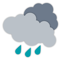
Rain. High 17.
Tuesday
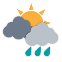
A mix of sun and cloud with 60 percent chance of showers. High 21.
Wednesday
A mix of sun and cloud. High 24.
Thursday
A mix of sun and cloud. High 26.
Tonight
Clear. Becoming partly cloudy this evening. Low 10.
Saturday
Sunny. Becoming a mix of sun and cloud in the afternoon. High 25 except 28 near Pemberton. UV index 7 or high.
Sunday
A mix of sun and cloud. High 23 except 26 near Pemberton.
Monday
Rain. High 17.
Tuesday
A mix of sun and cloud with 60 percent chance of showers. High 21.
Wednesday
A mix of sun and cloud. High 24.
Thursday
A mix of sun and cloud. High 26.
Alpine Forecast
Issued:
Friday, July 26, 2024 at 8:03:59 PM PST
Tonight

Clear periods.
Low 9 °C.
Light ridge wind.
Freezing level: 3300 metres.
Saturday
A mix of sun and cloud with isolated showers.
High 16 °C.
Wind west: 10 km/h.
Freezing level: 3800 metres.
Precipitation: Trace.
Sunday

Cloudy with sunny periods.
Low 6 °C, High 11 °C.
Wind southwest: 15 km/h.
Freezing level: 4000 metres.
Monday
Showers.
Low 7 °C, High 8 °C.
Wind southwest: 20 km/h.
Freezing level: 3700 metres.
Precipitation: 8 mm.
Tuesday
Mainly cloudy with isolated showers.
Low 7 °C, High 8 °C.
Wind southwest: 10 km/h.
Freezing level: 4800 metres.
Precipitation: Trace.
Wednesday
A mix of sun and cloud with isolated showers.
Low 7 °C, High 11 °C.
Light ridge wind.
Freezing level: 4800 metres.
Precipitation: Trace.
Thursday
Sunny with cloudy periods.
Low 10 °C, High 21 °C.
Light ridge wind.
Freezing level: 4900 metres.
Friday
Cloudy with sunny periods.
Low 17 °C, High 24 °C.
Wind light to 15 km/h.
Freezing level: 5000 metres.
Saturday
Cloudy with sunny periods.
Low 19 °C, High 25 °C.
Light ridge wind.
Freezing level: 4900 metres.
This alpine forecast is provided by RWDI