Updated March 22, 2022
Stroll, amble, meander, these words evoke a leisurely walk taken for pleasure. The pace is relaxed. The sun is out. Getting from A to B isn’t a chore, but a journey you’ve chosen to undertake with the chance of a wander to undisclosed C and D locations, if they take your fancy. Take your time, slow your gait and take in spring in the mountains.
Spring in Whistler is wonderfully unpredictable, bringing with it a duality that is fun if you don’t mind the odd snow flurry. However, the days of the white stuff are numbered as the sun beats it back and our pathways and trails emerge from their winter blanket. It’s time to stretch our legs, enjoy the feel of the spring sun on our faces, take in the changing vista and welcome back the buds and the birds.
Whistler’s Valley Trail
We’ve kept our early spring stroll selections to the 46-kilometres of Whistler Valley Trail because many of our other trail systems are still emerging from the snow. In the early spring (April), Lost Lake Park, Train Wreck and Cheakamus Forest still typically have large chunks of pathway filled with compact snow and ice. If you’re brave and don’t mind watching your feet, you could go for these as long as you’ve got some good footwear with traction devices (like Yaktrax), but this post is about easy strolls.
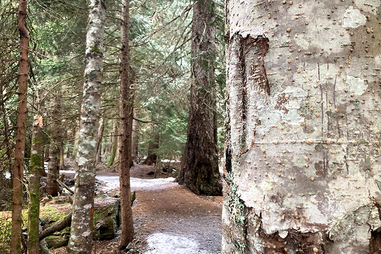
The Whistler Valley Trail weaves in and out of different neighbourhoods, by parks, lakes and beaches (take a look at the map). It’s a multi-use trail, so you’ll see hikers, bikers, skaters, families with strollers and dogs on leashes making their way along the gentle winding pathway. Although the Whistler Valley Trail is almost entirely free of snow at the start of April this year, there are still a few patches around Nicklaus North to Whistler Secondary School and Meadow Park to Rainbow Park to be aware of.
Green Lake to Whistler Village
From Whistler Village, take the 30 / 32 / 10 bus to Emerald Estates. You’ll need to press the bell after you’ve left Rainbow as the Green Lake lookout spot is the next stop along the highway. From here, you can walk all the way along the Valley Trail back to Whistler Village, a seven-kilometre walk, which will take approximately an hour and a half (depending on your meandering speed).
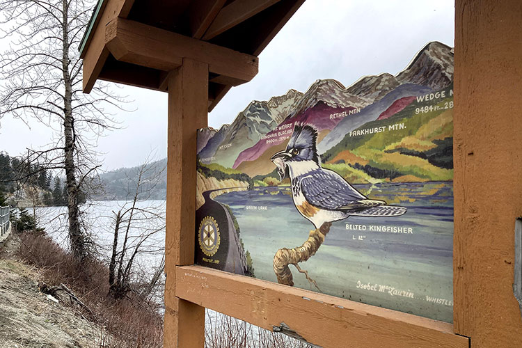
When you get off the bus, you’ll be looking out over Green Lake and a wide mountain vista; look out for the hand painted signs that tell you their names. You’ll also be able to see Nicklaus North Golf Course on the south side of the lake, which you’ll pass by on your route.
There are some loose, gravel trails down to the water’s edge but if you’re tempted by a dip, remember that it’s glacially fed (read – cold). Green Lake is the start of rafting adventures in the warmer months, and it’s also the end of the River of Golden Dreams which can be navigated in a canoe, kayak, or SUP.
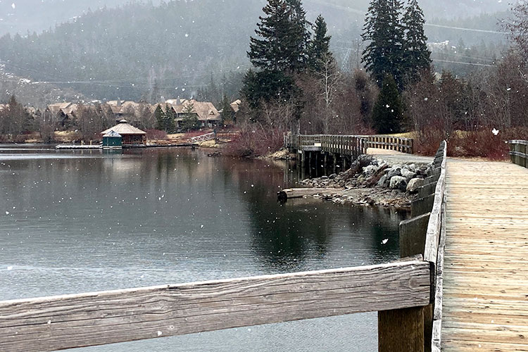
Staying on the left side of Highway 99, the Valley Trail leads you over Green Lake on a boardwalk section that gives you views back over the lake in the other direction. Floatplanes start to take off and land here in May, and this is a fantastic place to watch from. If you’re hungry or thirsty, you’re close to Table Nineteen at Nicklaus North Golf Course (check the dining guide for current hours). Their patio has one of the most epic views in Whistler, so it’s a lovely place to sip on a morning coffee or luxuriate over a cold beer or wine in the afternoon.
As you continue along the Valley Trail, you’ll see signs for Lost Lake Park on your left. When those trails are free from the snow that’s another route you can take back to the Village, but in early April the Valley Trail is a safer bet. The Fitzsimmons Creek will soon come into view on the left as will the bridge over to the Scandinave Spa (a good place to relieve tired muscles after a good stroll).
If you’ve made it to this point and you’re in need of more java, lunch, or a snack, head right before you walk onto the Fitzsimmons Accessible Nature Trail and cross Highway 99 to get to Nesters. This small shopping area is home to Nesters Market, La Cantina – Nesters (great tacos), Samurai Sushi and The Bunker Cafe.
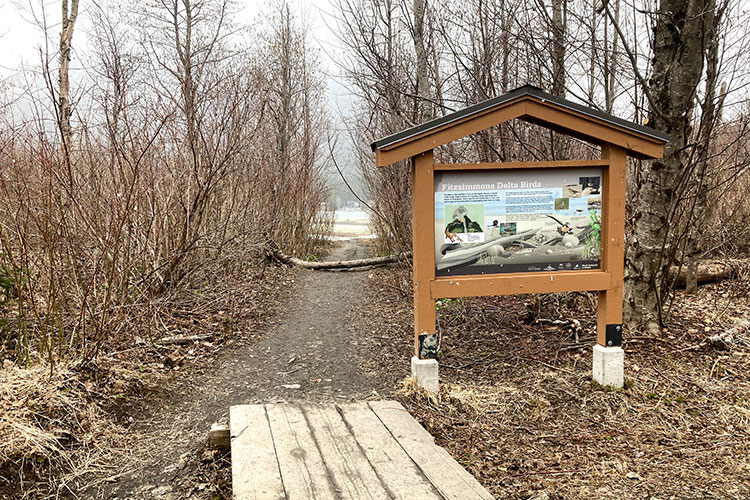
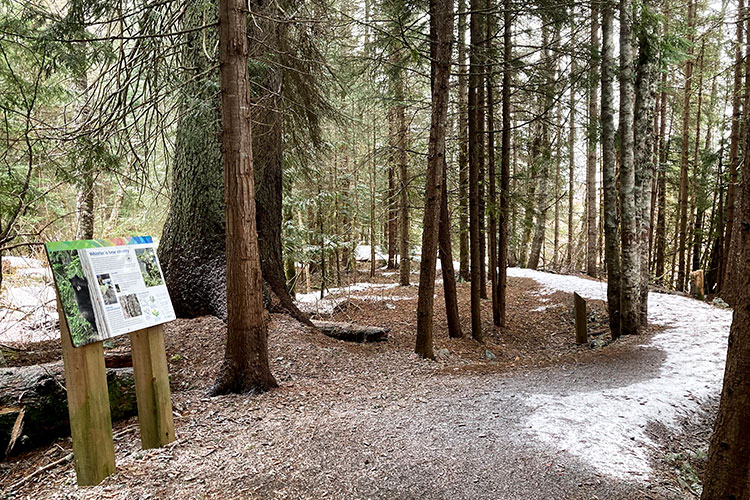
The Fitzsimmons Accessible Nature Trail is usually free of snow by April (there still might be a few patches). This 800-metre trail runs next to Fitzsimmons Creek, a wetland area and a mixed forest with old growth trees. Look out for claw marks on some of the trees; the bears like to use them as scratching posts! For more on our large, furry friends read, Be Bear Aware in Whister’s Backcountry. You can also download the free, Go Whistler Tours app for a self-guided tour down the Fitzsimmons Creek.
At the end of the nature trail, you can turn left towards the entrance of Lost Lake Park, the Squamish Lil’wat Cultural Centre and the Upper Village, or right towards Whistler Village North, where Whistler Marketplace is located. Another option is to turn left and then right before the bridge that takes you over Fitzsimmons Creek. This part of the Valley Trails takes you up towards the base of Whistler Mountain, past the Skate Park, pump track and Audain Art Museum. At the end, you’ll either take a left toward the Upper Village, crossing a charming covered bridge or right towards Skiers Plaza, where the Whistler Village Gondola is.
Other Valley Trail Springtime Stroll Suggestions
Short Valley Trail Option: The loop around Whistler Golf Course (4.8 km / 1 hour) is beautiful. Looking across the greens coming out of the snow you get fantastic views of the mountains from all directions as you do the full, gently undulating loop. At this time of the year, the golf course team urges people to stick to the Valley Trail, as their teams are busy getting things ready for tee off.
Medium Valley Trail Option: Walk from Whistler Village to the end of Lorimer Road (2.5 km / 30 minutes) and go left to Rainbow Park (1.5 km / 18 minutes) or right to Meadow Park (2.9 km / 35 minutes), with the option of hopping on a bus there or following the Valley Trail back round to the Village on either side of Highway 99. Be aware that the parks will still have some snow, or where it’s melting they will be waterlogged; to help the grass grow back try not to tread on it as you explore. These two routes might also still have patches of snow on them, but it’s fading fast and there are usually obvious places where you can go around to avoid the slippy stuff.
Long Valley Trail Option: Walk to Function Junction via the Valley Trail (10 km / 2 hours) and explore the breweries, shops and bakeries before catching the number 10 or 20 bus back to Whistler Village. For this route, you’ll have to cross over Highway 99 at Creekside to continue along the Valley Trail through Spring Creek; the RMOW is currently working on a connecting section of Valley Trail on the same side for a more direct route, so watch this space! Read, Is Function Junction Whistler’s Coolest Neighbourhood for why you’d want to make this trip.
For more strolling options, take a read of Whistler Walks on the Mild Side.
Make It a Mindful Meander
Informal, mindful walking is exactly what it sounds like. It’s a way to stay present and connect with what’s around you, rather than letting that pesky autopilot kick in, which distracts us from the moment with things like what’s for dinner.
As you stroll, try to work through the senses. Feel the ground beneath your feet and the way your foot connects with it, the way your hips and arms gently swing with the movement. Take a moment, safely, to close your eyes and see what you can hear. Don’t force it, just listen. The wind through the trees, the whooshing of a bird in flight, the scurry of a squirrel’s long nails as it scampers up a tree trunk.
Next, think about what you can smell; the sun heating the nearby pine trees, the earthiness of the soil emerging from the snow, the distinct fragrance of skunk cabbage or other early spring blooms.
Open your eyes and take in the visuals that surround you, the colours, shapes, textures. Mindful walking can help to keep you in the moment, refocus that monkey brain and helps to calm and relax you – enjoy!
Make It a Mission
Your mission, should you choose to accept it, is to find Whistler geocache stashes on your next stroll. Ok, maybe this doesn’t quite fit into the gentle amble theme, but if you bring the kids or your other half struggles with the relaxed pace, this could be the perfect activity to dispel some of that energy. Connect with your inner geek; download the app to your phone and navigate to hidden spots all over Whistler, including some along the Valley Trail.
What to Take On Springtime Strolls
Our advice for this time of year (April and May), is to be prepared for all types of weather and all kinds of trail conditions. If you’ve packed your sandwiches and are thinking of having a picnic, pop a small towel or blanket in your bag to wipe down any wet surfaces – like a dewy picnic table.
- Waterproofs
- Good walking shoes
- Traction devices for your shoes – like Yaktrax
- Hat and gloves
- Sunglasses
- Sunscreen
- Towel / small blanket
- Filled water bottle
- Snacks / lunch
- Hand sanitizer
This is a simple list for short springtime strolls, but if you’re planning on going for a longer or more arduous walk or hike visit AdventureSmart for a list of what to take and how to plan for safe exploration.
Save up to 20% on lodging with Whistler.com this summer. Stay & Golf from $289 CAD per person, per night or Stay & Bike from $179 CAD per person, per night. Sign up to be a Rewards Member (for BC and WA residents only) and receive a FREE $50 CAD activity voucher on stays of 3+ nights.
You can also win a summer trip to Whistler with the Escape the Ordinary contest!