Green is a colour of depth and variation. It resonates calm. It invites immersion. There’s no better place to bathe in green than the Sea to Sky and Valley trails, multi-use paths that twist their way through Whistler.
Accessible, signed and paved, these trails are awash in nature. They are also available for use before most hiking trails are snow-free. So slip on comfortable shoes, fill the water bottle, pack some provisions and get ready for. . . green.
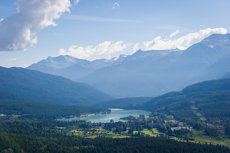
The Sea to Sky Trail winds 180 kilometres / 110 miles from the Pacific Ocean through Whistler and beyond. It’s part of Canada’s Great Trail, a network of greenways, waterways and roadways connecting the nation.
The Valley Trail snakes through Whistler’s neighbourhoods, taking in world-class sports facilities and providing access to rivers, parks and lakes. With more 40 kilometres / 25 miles of gentle, rolling paths, it’s the milder side of the Whistler wild.
Start at the Visitor Centre at the Gateway Loop in the heart of the Village. You’ll want the Whistler Valley Trail Map, which details paths, distances and public facilities.
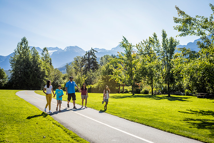
Here are two suggested walks. One, along the Valley Trail, takes in waterways and wildlife. The Sea to Sky Trail walk, meanwhile, features beaches and boats. These routes can be amended to suit your needs, both are mellow and don’t require a high fitness level.
Walk 1. A River Flows Through It
This Valley Trail stroll is all about waterways and wildlife. The 5-kilometre / 3-mile walk starts at Meadow Park Sports Centre, where there are washrooms, picnic areas, a playground and sports facilities, and winds its way back to the Village.
Busing from the Village to Meadow Park is easy on routes 30 and 32; both can be found in the Village at the Gondola Transit Exchange on Blackcomb Way. Bus schedules are available on the BC Transit website. So is information on fares.
From Meadow Park Sports Centre, with your back to the building, head right towards the large Valley Trail sign at the end of the parking lot. Take a moment to get oriented at the signboard with maps, directions and distances. Then head left, towards the wooden bridge over the meandering River of Golden Dreams, with its rainbow trout, Dolly Varden char and Kokanee salmon. As you cross the bridge, notice the canoe and kayak pullout for paddlers who’ve made their way along the 5-kilometre / 3-mile river from Alta Lake, where paddling tours originate.
At the first set of stoplights, cross the Sea to Sky Highway, following the sign to Lost Lake Park. Stay on the Valley Trail and you’ll hit another bridge as you again encounter the River of Golden Dreams. Turn right along the path, where you’ll soon have the opportunity to spy an osprey. These beautiful birds of prey return in pairs to the same nest year after year. Good luck finding that nest in the trees! They are just part of Whistler’s amazing wildlife.
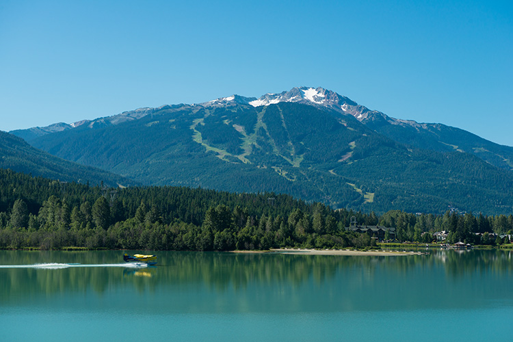
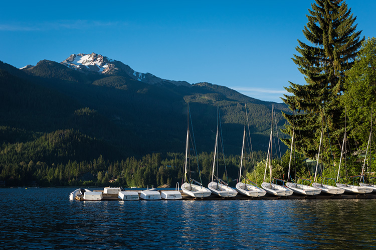
The trail continues along the banks of glacier-fed Green Lake, a catch-and-release fishing lake that’s up to 40 metres / 130 feet deep. Clatter your way over two wooden bridges and towards the seaplanes, which offer sightseeing tours and passenger service to Whistler in the warmer months.
It’s time for a path less travelled. At the floatplane dock, you’ll see a beaten-earth path straight ahead, paralleling the lake. It’s a magical entry to the Fitzsimmons Delta, where glacier-fed Fitzsimmons Creek meets Green Lake. The Sea to Sky Corridor is part of the Pacific Flyway, extending from Alaska to Patagonia, and along which more than a billion birds migrate each year.
Steering clear of the area designated for wildlife and nesting, follow the path to the Delta. This is where the green of the lake and the mountains converge. After some meditative moments, stroll back to the Valley Trail and follow the signs for Whistler Village.
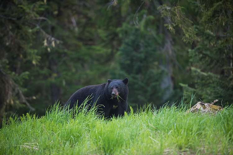
If you see bear scat along this trail, or any of Whistler’s walkways, don’t let it jar the meditative mood! Be bear aware, giving it plenty of room.
Deltas and ducks behind, the trail crosses train tracks, curving around the driving range. From golf skills to goods trains, there’s always something to see. The trail now takes its lead from Fitzsimmons Creek, named after the miner who once worked the creek-head.
About 2 kilometres / 1.2 miles along, the Valley Trail intersects with the Fitzsimmons Accessible Nature Trail, an 800-metre / half a mile forest experience. With flat, stable surfaces, this trail is accessible for all ages and abilities. You can opt for more walking there or remain on the Valley Trail. The Village looms, full of life, yet still overarched by green. This walk is completed.
Walk 2. Beaches and Boats
If the beach beckons, walk two is for you. It’s about 6 kilometres / 3.7 miles from the Village to Lakeside Park on Alta Lake and back again along a gently rolling path, in which the Sea to Sky and Valley trails briefly become one.
From the Village Centre, walk along the back of the Whistler Conference Centre on Whistler Way. You’ll find seating, a trail map and a water fountain before ducking under the Sea to Sky Highway towards the Whistler Golf Club.
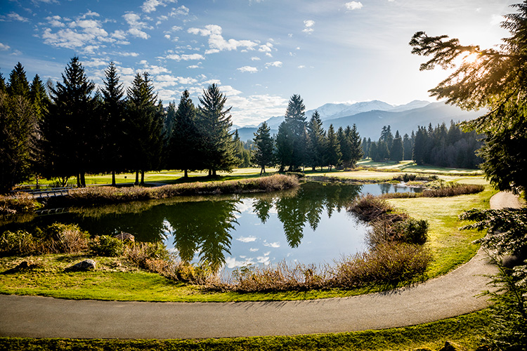
Look for signs on the left, immediately after the underpass, for the Sea to Sky Trail. Head through the yellow barricades and into the woods. This part of the Sea to Sky Trail winds over gentle hills and through soft, shady conifer forest. Although the highway is to one side of the path and the golf course the other, the lush, deep undergrowth and wide canopy create a muffled stillness. Emerging from the forest onto Blueberry Hill; this is a great place to watch golfers tee off over water features.
It’s important now to look for signs to Lakeside Park. Cross Blueberry Drive to the right of the golf course and head down St Anton Way and then Archibald Way. Continue to follow the signs, turning right as you see the lake. The trail runs in part along the road, so take care. It’s not far now!
Lakeside Park can be lively. And it offers full facilities. There are washrooms, changing rooms, swimming docks, watercraft rentals, picnic areas and a stand selling snacks. Want to glide down the River of Golden Dreams? Excursions start here. You can relax at this beach. . . or not. Beyond it, over a wooden bridge, a shoreline path leads to an elevated Stone Circle. The perfect place for views and selfies, it is also available to book for special events such as an intimate wedding.
This isn’t Alta Lake’s only lakeside offering. A short distance along the Valley Trail is the smaller Wayside Park, which also offers swimming, paddling tours and other facilities. You’re now about 3 kilometres / 1.8 miles from the Village. Follow the same trail back, but not before taking a well-deserved beachside break.
Ready to start your Whistler walking? Stop by Whistler.com to start planning your holiday and discover more hikes and walks.