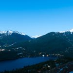
The Callaghan Valley is a secluded paradise is nestled in the mountains just south of Whistler. A plethora of lakes, waterfalls, hikes, glaciers and untouched mountainscapes make up the Callaghan region. Its unrefined beauty is perfect for adventurous souls seeking opportunities to feel the power of the immense landscape.
The only problem with the Callaghan, which isn’t really a problem – is choosing what to do! Here’s our best stab at decoding the Callaghan Valley so you can pick the perfect adventure each and every time you visit.
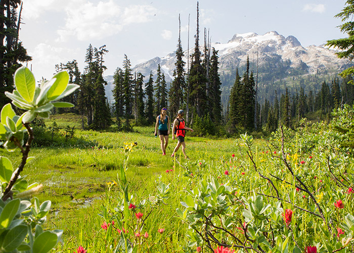
Head north on Callaghan Road until it drops you at the gate of Whistler Olympic Park. This location combines a world-class destination for Nordic sports in the winter with a stunning RV & Campground experience in the summer.
The Park is open daily from 8 AM to 8 PM, June to September, and admission is complimentary for the day. Explore the many hikes available with free park access. If hiking isn’t your thing, there are plenty of other attractions, including biking, summer biathlon, disc golf and sightseeing. With an abundance of cool stuff to do, you might even want to snag a campsite and turn it into an epic overnighter!
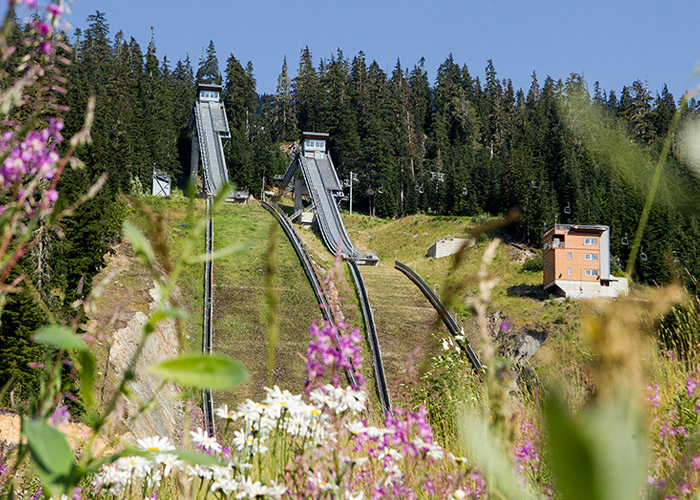
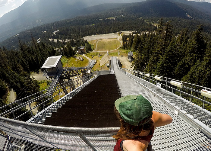
Whistler Olympic Park Ski Jumps & Top of the World Lookout
Length: Under 2 km, varies with selection.
Difficulty: Easy, but steep at times.
Need to know: Access is free with the parking fee. Closed-toe shoes are required.
Climb up the Olympic ski jumps landing area, then onto the stairs and finally reach the reward of the view. Top of the World lookout is another hike that offers incredible views of the iconic Black Tusk.
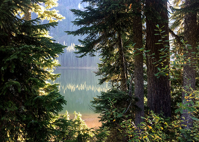
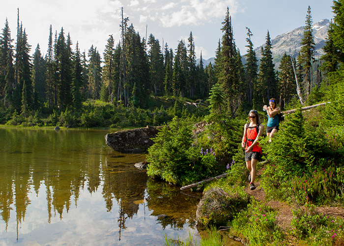
Madeley Lake Hikes
Length: 1 – 26 km round trip
Difficulty: Variable
Need to know: Close to the Olympic Park is Madeley Lake, you can easily experience both in the same day. On Callaghan Road headed north, take the exit to the west at the Callaghan Country sign (just beyond Alexander Falls), cross the bridge and after a few hundred metres turn right. The trails are well-signed but having a map saved to your phone is a great idea or pick up the Clarke Geomantic Topo Map at Escape Route before you go. You can drive right to the lake before the road is impassable. Here you can walk around the lake or hike to Beverley Lake and on to Rainbow Lake to Sproatt Mountain or to Hanging Lake. Beverley Lake is part of the Rainbow Trail network and can be taken as a traverse or as an in-and-out hike, please note some of the Rainbow Mountain trails are not dog-friendly. Find everything you need to know about hiking Rainbow Mountain in this blog. The access to Hanging Lake, a popular winter destination for ski tourers, is not maintained and at times poorly marked in the summer. The bears are plentiful in these parts, be bear smart. On some maps, Madeley Lake is referred to as Powell Lake and is dog-friendly.
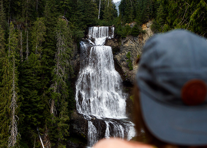
Alexander Falls
There is a trail to the base of Alexander Falls in the winter (great snowshoeing), but in summer it becomes overgrown and dangerous. We advise you to enjoy the beauty of the waterfall from the viewing platform.
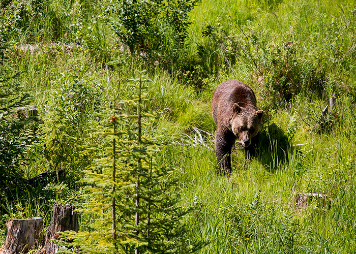
Bear Tours
Callaghan is known as the top spot for bear viewing in the Whistler region and we simply cannot talk about it without mentioning the opportunity to safely see bears on your trip to the Callaghan. Tours by Whistler Photo Safaris and Canadian Wilderness Adventures are both educational and offer great photography opportunities for all!
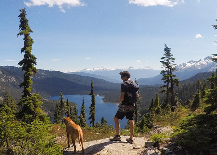
Callaghan Lake Area
The hub for hiking in the Callaghan Valley is at Callaghan Lake. To reach the lake you’ll need a vehicle with clearance and ideally all-wheel-drive. After 8.5 kilometres of bumpy car time you’ll be pleasantly surprised with a majestic view of Callaghan Lake. Spend the day stand up paddle boarding, kayaking, floating or fishing at the lake. Any time here will surely burn the beauty of the lake into your memory. Speaking of burns, there are permitted fire rings for fires but please note that we are in an extreme heat wave and fires are prohibited everywhere in the surrounding Whistler area. See Leave No Trace: Whistler Hiking/Biking and Backcountry Etiquette
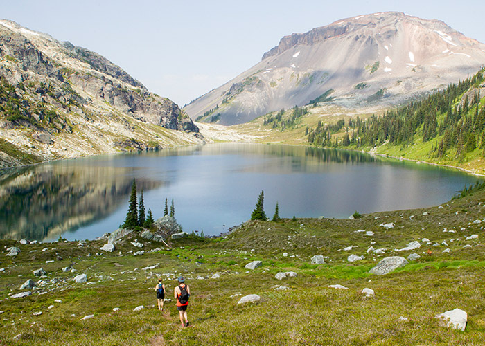
Conflict Lake
Difficulty: Intermediate
Need to know: This 5-kilometre hike will fly by as its terrain varies from old growth forests to rolling rocks and sub alpine ponds. There are a few boardwalks over ponds so bug spray is a good idea. The lake is stunning, be sure to bring a suit! Sneak glimpses of the luxurious Journeyman Lodge in the distance from the lake – the perfect winter retreat for cross-country and backcountry skiers alike. The trailhead for Conflict is unmarked and 100 metres down from the boat launch on the road you drove in on.
Ring Lake
Length: 10 km one way.
Difficulty: Difficult
Need to know: Ring Lake is accessed by hiking beyond Conflict Lake, follow the instructions for accessing Conflict Lake and once there, continue past the lake and watch for the trail on the right of the valley. You’ll follow the outflow of the lake and gain elevation. There are ladders and tricky water crossings at times, this hike is for the agile-footed. The rewarding, stunning lake and view of Ring Mountain behind might just beg you for a trip extension to summit, and it is obtainable for those with energy left in the tank.
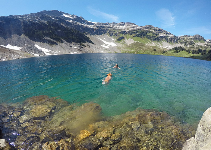
Cirque Lake
Length: 2 km one way.
Difficulty: Moderate – Difficult
Need to know: First things first, you need a water vessel to get you across Callaghan Lake before you can begin the hike and no, an explorer won’t do. Rentals are available from Kahuna Paddleboards or Escape Route and make for a great mode of transportation if you don’t own a canoe or kayak. Put in at the boat launch and paddle across the lake which is roughly 2.6 kilometres – a decent paddle no doubt! Head straight across towards the waterfall on the far side of the lake. You’ll notice to the right of the waterfall there’s a small beach area perfect for pulling out your water transportation device and beach it safely in the trees off the trail. This trail is not well-marked but is defined enough to follow. You’ll gain a steep 300 metres in 2 kilometres, including a boulder field scramble, climbing ropes in the steep trees and up a few smooth rock rolls, but of course this is well worth the effort. The glacial Cirque lake certainly doesn’t feel tropical to the touch but looks it. Easily one of the most beautiful lakes in the Whistler area.
Just a short commute from Whistler and you’ve opened up a whole new world of hiking and exploring options. The Callaghan Valley is well worth the drive to see a few new hidden gems the Whistler area has to offer.
Stoked on hiking in Whistler? Check out our collection of hiking posts from the Whistler Insider. The Whistler Visitor Centre is the place to go when you arrive for current trail conditions, and for all other Whistler information, Whistler.com is your go-to site.